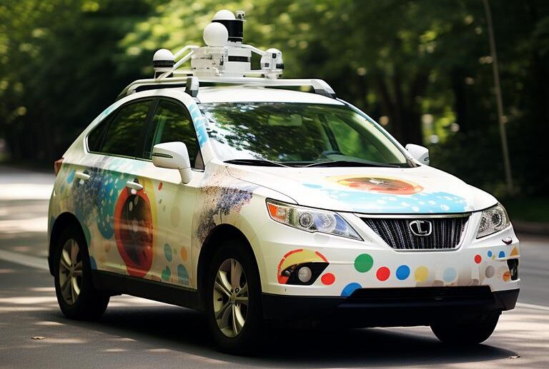
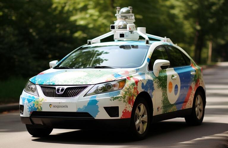
In the era of digitalization in which we move, offers Google Maps an essential feature by allowing us to virtually explore almost every corner of the world. One of the most fascinating features is without a doubt Street View, a technology that takes us on a virtual journey along roads and around the world. But what is behind the technology? The Streetview vehicles, commonly known as Google Maps Cars, play a crucial role here. The Google Maps Cars, with their distinctive roof-mounted Camera domes, are traveling worldwide 360 degree shots of streets from the “Worm's perspective" to create. With a specially developed Camera system, which is equipped with a total of 15 lenses, every corner of the environment is captured.
Google Maps Cars
The cameras on Google Maps cars are designed to panoramic shots to shoot, which will later be linked into seamless, interactive images. The ones built into the cameras Sensors capture up to 65 megapixels per image, allowing for impressively detailed views. This is a lesser-known but essential component of mobile camera units GPS device. It ensures that every photograph taken can be precisely geolocated, allowing for later integration into the Google Maps platform is essential. The technology is supplemented by Laser radar systems (Lidar), which are used to scan the environment in 3D and measure distances between the objects and the vehicle.
This creates the 3D views and models that give users an immersive experience while “Roamingon Google Maps. The data processing that follows after the images have been taken is also interesting. With the help of artificial intelligence and advanced algorithms are used to identify faces and license plates automatically obscuredto protect people's privacy. In addition, the algorithms allow the recognition and addition of information about shops and services as well as the updating of traffic signs and street names in the Google Maps service.
Vehicles are continually being developed
Over the years, Google has Streetview vehicles continuously developed. The first vehicles of this type were ordinary cars that were upgraded with the necessary equipment. However, over time, special ones have also been developed Trikes (three-wheeled vehicles), snowmobiles and backpack cameras for pedestrians, so-called Trekker, introduced to be able to capture even remote and hard-to-reach places. The variety of vehicles makes it possible to cover a wide variety of environments such as deserts, mountain paths and inner cities, and to cleverly integrate the necessary technology.
While the general function and technology of the Streetview vehicles Although it has remained the same over the years, adjustments and optimizations have been made. This is how the design of camera domes has become over the years more aerodynamic designed and the Camera technology brought to the latest standards to enable even sharper and more stable recordings. The weather poses a particular challenge - Google has responded to this by developing robust and weatherproof housings for the cameras as well as adapted software algorithms that ensure high-quality recordings even in less than ideal conditions.
Data protection is always a challenge
In the context of the ever-increasing importance of data protection, Google has also made adjustments. So improved techniques became available anonymization of people and vehicles and the guidelines for submitting applications for the defacement of buildings and land communicated more clearly. A final point that should not be neglected is the involvement of the community: via the platform “Local Guides“Users can upload self-taken images to Google Maps and thus help to cover regions to which the Streetview vehicles cannot advance.
This is not only a great opportunity to participate, but also provides a unique perspective on local features and insider tips from all over the world. The continuous process of further development and improvement of Google Streetview vehicles and technologies guarantees that increasingly precise and detailed virtual maps will continue to be available to us in the future. They allow us to explore the world from our screens and constantly discover new things. Photo credit: Images are sample images and not real
thematically relevant posts
In our category Tips, products, information & Co We have reviews of car or accessories manufacturers, new ones Tuning Wiki Terms or one or the other Leak veröffentlicht.
|
Google Maps Car Tracking: How does it work? What do you have to set?
|
Save Google Maps offline? No problem!  |